Places around the Sound
|
As you can see, the South Sound has many inlets, bays, coves and passages, a difficult charting job. Vancouver gave Whidbey and Puget five days for the work. When they did not return at their deadline, Vancouver, an impatient man, set out with then Third Lieutenant Joseph Baker in the longboat and gig to find Puget. Puget headed back to HMS Discovery near present-day Seattle on May 26, and the two parties saw each other at dusk, mistaking one another for Indians. Vancouver marked the present site of Olympia the next day at 47 degrees, three minutes north latitude, and also headed north. So impressed was he with Puget’s charts that he named the South Sound, “Puget’s Sound.”
|
|
|
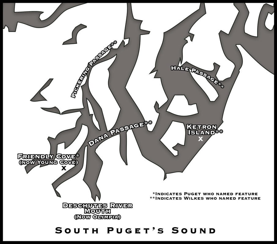
This encampment sketch of Lieutenant Peter Puget on Puget’s Sound is probably the May 25, 1792 encampment of Puget, Whidbey and Menzies on the north end of Griffin Peninsula, near Steamboat Island. Their journal described their location on the south shore of Squaxin Passage as in “a very pleasant situation.” They look west toward sunset with the Mason County hills in the distance. (Courtesy of Washington State Archives)
|
|
|
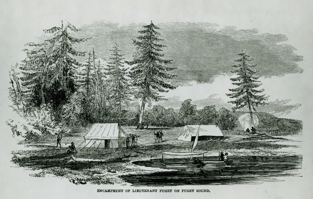
Pictured here is one of two coves across the inlet from one another where Puget landed May 26, 1792, to encounter Indian villages, probably Squaxin. This cove, on the west side and now known as Young Cove, Puget named “Friendly Cove” from the nature of the amicable reception he received from its residents. (Photo by John Hough)
|
|
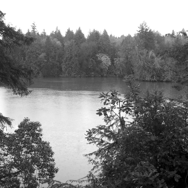
Mount Rainier
This spectacular, 14,408 foot peak in Washington State’s Cascade Range was named Mount Rainier by Vancouver for his patron, Peter Rainier, RN. In 1841, Charles Wilkes of the US Navy measured it, and Dr. William Tolmie of the Hudson’s Bay Company’s Fort Nisqually was among the first to climb it. (Photo by John Hough) |
|
|
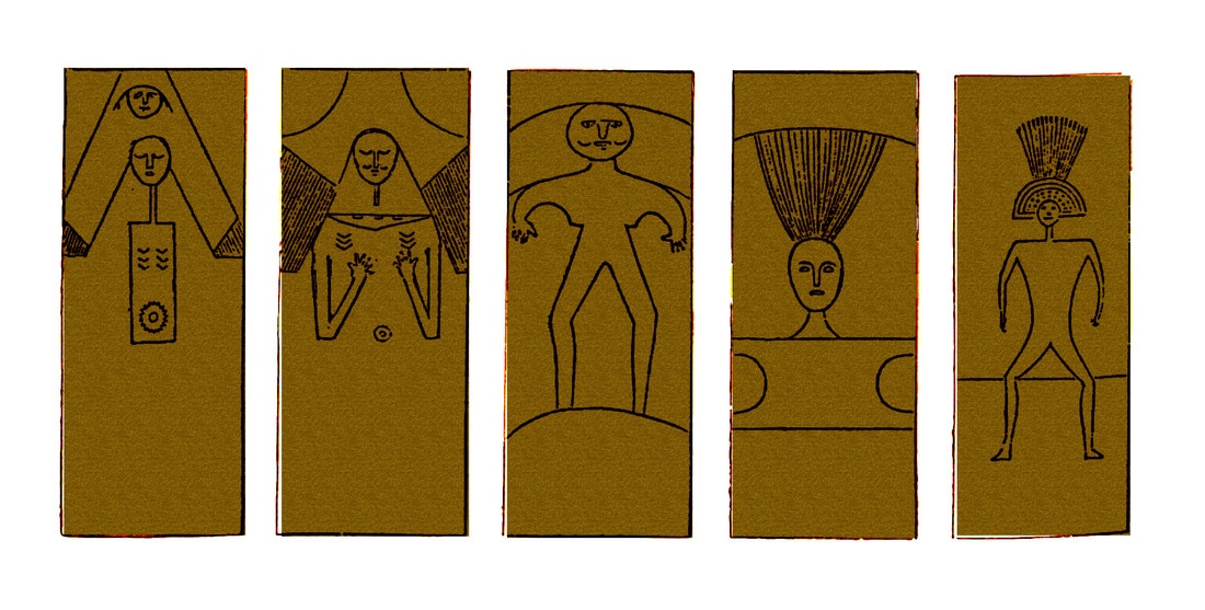
Black River Carved Planks
In their trek up Eld inlet and McLane Creek through Black Lake to the Black River, Eld, Brackenridge, Colvocoresses and their party encountered these carved planks erected near the confluence of the Black and the Chehalis rivers. They attributed these mysterious figures to the Holloweena Band, a part of the Upper Chehalis Indian Peoples. (Artist’s rendering by Patrick Eldridge, from a representation in The Wilkes Expedition, Puget Sound and the Oregon Country, Frances Barkan, Les Eldridge, Drew Crooks, Washington State Capital Museum, 1987.) |
|
|
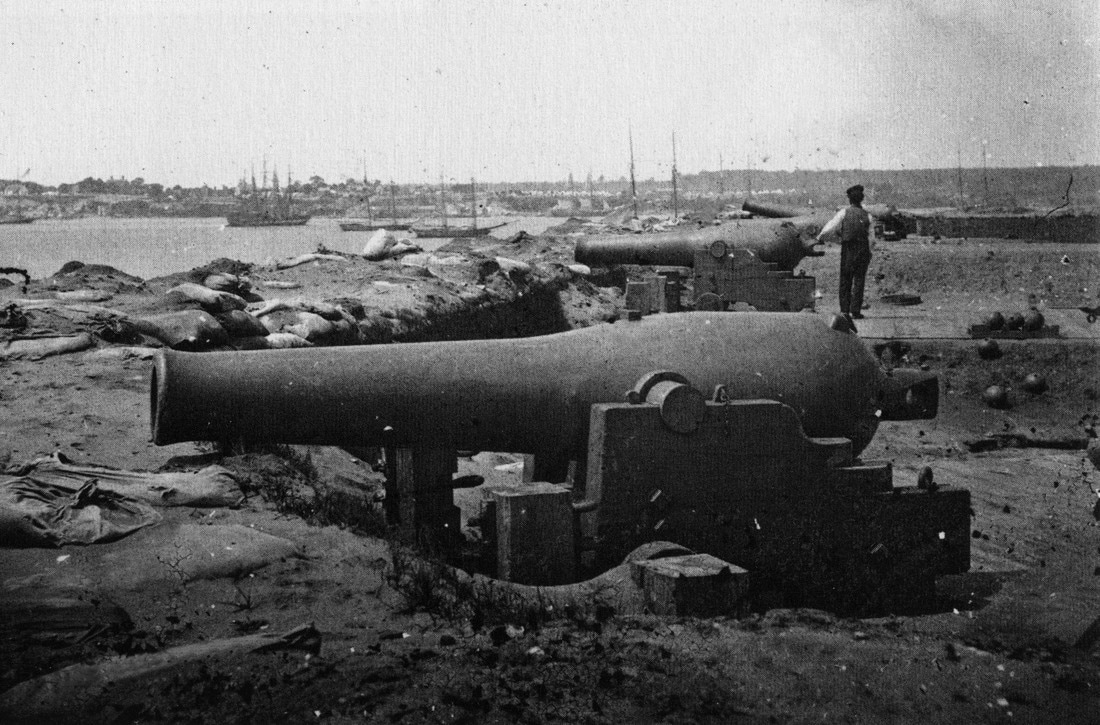
Pig War
Pickett had originally placed his infantry company at South Beach, an untenable location, and had been ordered to move it to the heights above Griffin Bay by his army commandeer, Colonel Silas Casey. Pickett was, after all, last in his class at West Point. The guns from USS Massachusetts were placed on the heights now known as American Camp in a redoubt, or fortification, designed by Army Lieutenant Henry Martyn Robert. The guns were trained on the British warships in Griffin Bay as tensions rose over the American presence on the disputed island. The US Navy steamer Massachusetts was a converted merchantman. She was actively involved in the 1855-56 Indian War and the 1859 Pig War. She visited Olympia during those conflicts. The cannon pictured here was one of eight she sent ashore to US Army Captain George Pickett to arm the redoubt at American Camp against the British in 1859. (Courtesy of Mike Vouri, The Pig War, Arcadia, 2008) |
|
|
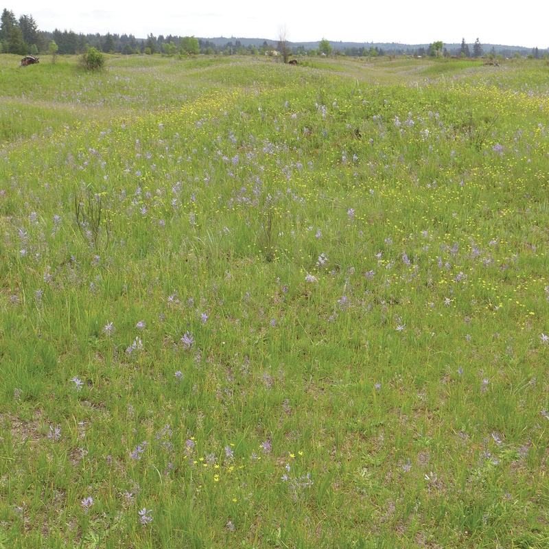
Mima Mounds
Geological mystery-mounds in Thurston County, the Mima Mounds evoked comment from Wilkes, and later, puzzlement from Dr. William Tolmie, a chief factor of the Hudson’s Bay Company in the Northwest. Controversy still rages over the origin of the gravelly mounds, preserved in two reserves by the State of Washington and by Thurston County. Giant gophers or glacial formations? Scientists differ yet. (Photo by John Hough). |
|
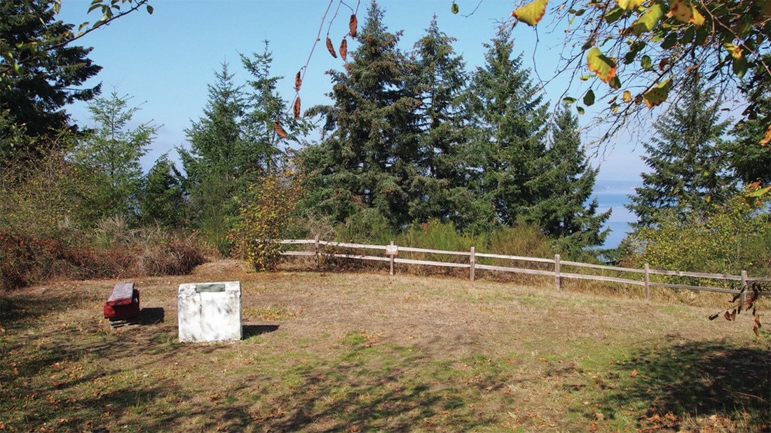
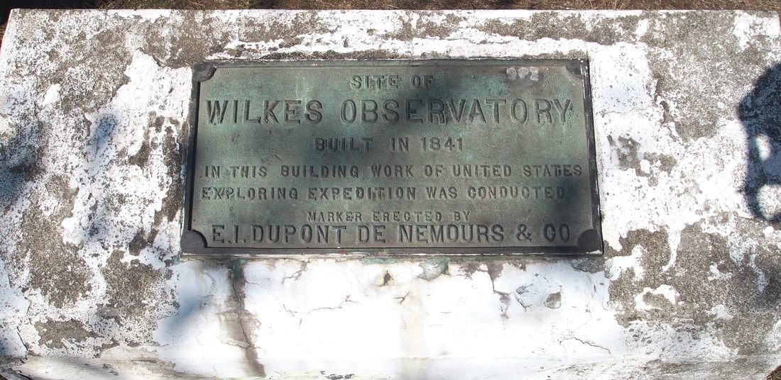
Wilkes Expedition observatory marker
This stone marks the location of the 1841 Wilkes Expedition observatory near Fort Nisqually. The observatory’s primary function was the operation of a tripod-mounted pendulum measuring the thickness of the Earth’s crust by differing rates of swing. Pierre Bouguer invented the process. Wilkes placed a similar observatory atop Mauna Loa. Its walls are still there. (Photo by Pat Eldridge) |
|
|
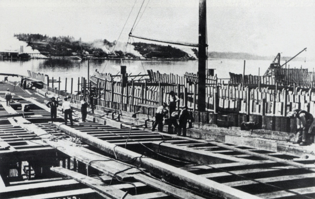
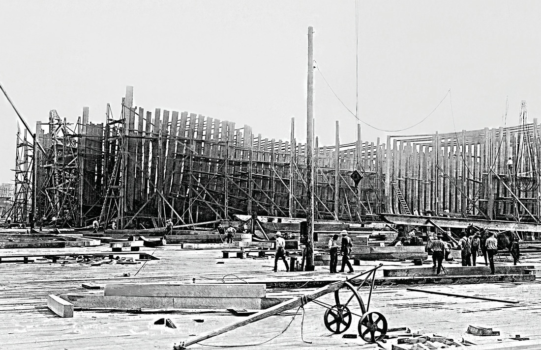
Ward's Shipyard
On of a number of late 19th-early 20th century shipyards in South Puget Sound, Ward’s was located on the present site of the Port of Olympia, which was organized in the 1930s. (Courtesy of Shanna Stevenson, Henderson House Museum; and Chuck Fowler) |
|
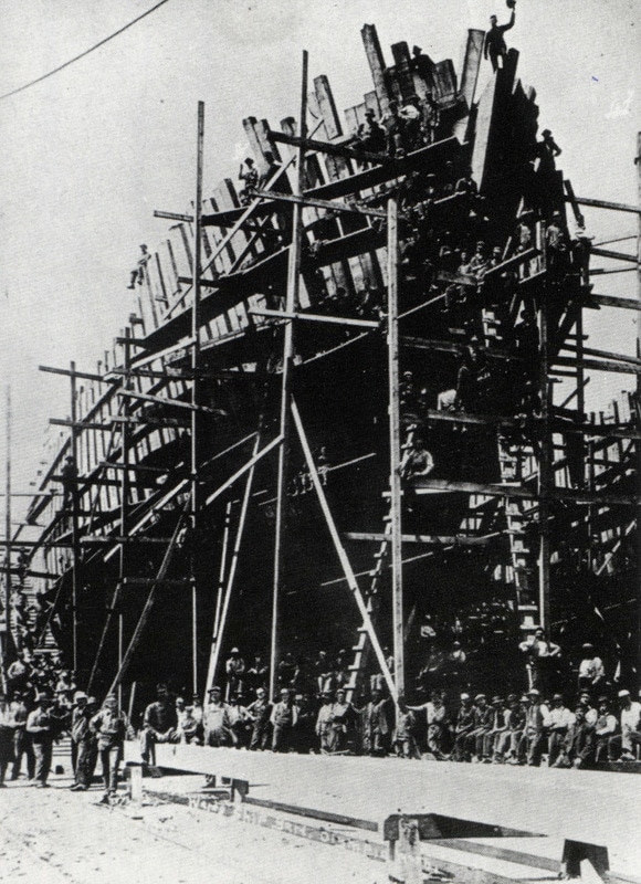
Olympia Shipbuilding Company
Later, the Olympia shipbuilding company occupied the same site. Auxiliary schooners were built here for the Army Transportation Corps during World War I. Shown here is a worker, waving his hat from a schooner under construction. (Courtesy of Shanna Stevenson, Henderson House; and Chuck Fowler) |
|
|
Shipbuilding was wide spread in South Puget Sound. Among the most notable Ward’s and Olympia Shipbuilding Company on Budd Inlet, where schooners were built in 1917 for America’s World War I effort. The site was constructed on materials from the Carlyon Fill. The popular site was later home to a third company, Sloan Shipyard. (Courtesy of Port of Olympia)
|
|
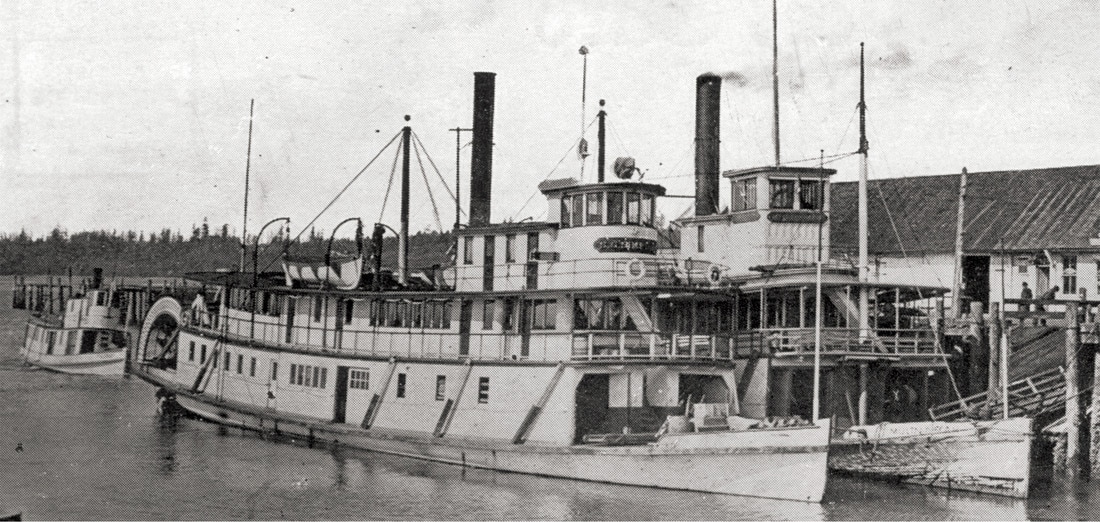
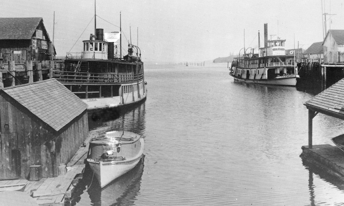
Percival Dock
In 1860, Sam Percival and his son built this dock, the entrepot to Olympia until the advent of the automobile. It could accommodate shallow-draft steamers. Pictured here are three, the S.G. Simpson, the Multnomah, and astern, the Mizpah. Other docks nearby helped serve the capital city: Horr’s Dock, Brown’s Wharf (1875) north of town for lumber schooners, and Gidding’s Dock (1854). (Courtesy of Washington State Archives) |
|
|
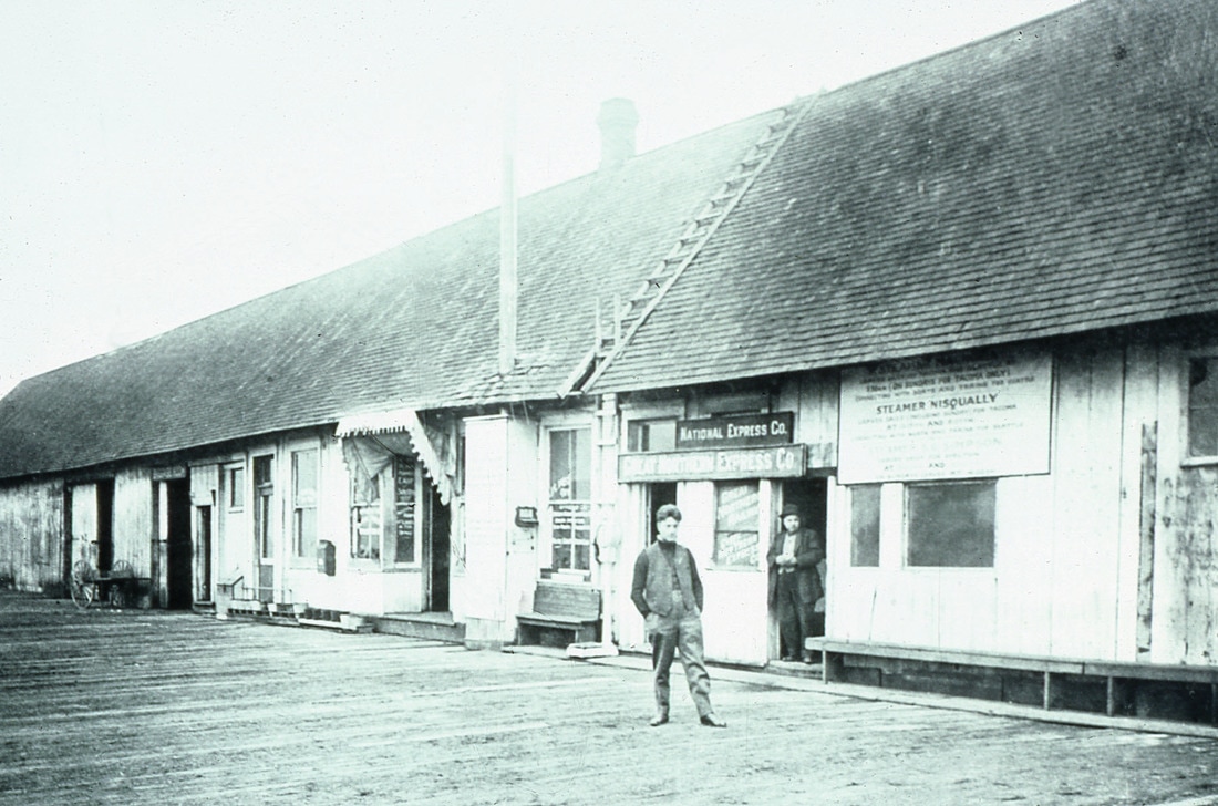
The dock built by Sam Percival and his son was the hub of commerce on the south Puget Sound. In addition to the many steamers calling there, numerous companies had their headquarters on the dock. National Express, a shipping company, was one.
(Courtesy of Port of Olympia) |
|
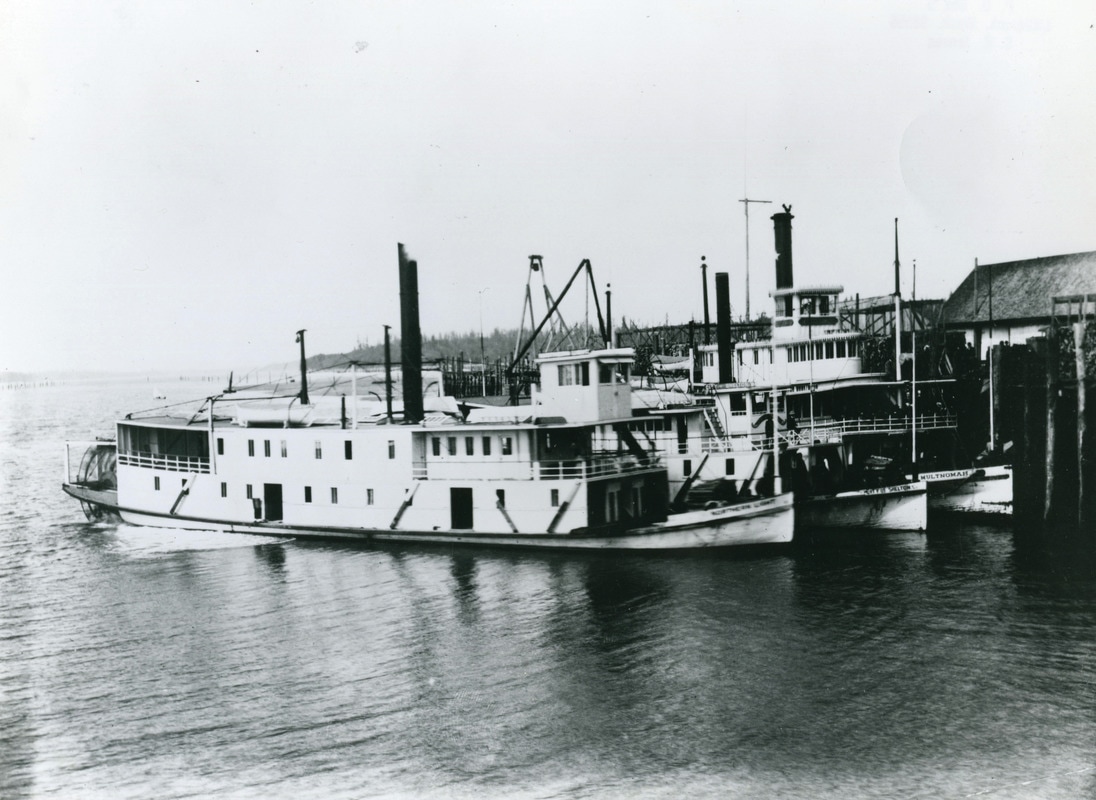
Pictured at Percival’s Dock are City of Shelton, a rival on the Shelton run, Northern Light, and the Multnomah. The 120-foot Northern Light was designed for the Yukon gold rush, but never left Puget Sound, running from Shelton for much of her career. The 143-foot Multnomah was built in 1885 for the Willamette River in Oregon, and purchased by Olympia’s Willey family for the Olympia-Seattle run in 1889. In 1911, she was sunk by collision with the steamer Iroquois in Elliott Bay, Seattle.
(Courtesy of Washington State Archives) |
|
|
Horr's Dock
This is a rare photo of Horr’s Dock, located across from Percival’s Dock. Percival’s site is now the City-owned Percival’s Landing, and the Horr’s site is now where the Olympia Yacht Club is located. |
|
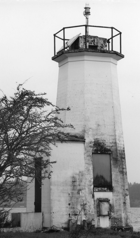
Dofflemyer Point Lighthouse
Dofflemyer Point Lighthouse is the first thing a mariner sees entering Budd Inlet by night. Isaac Dofflemyer established a land grant claim in 1865 at the point named by Wilkes in 1841 as “Brown’s Point”, after his carpenter’s mate, James Brown. With the name change came a light in 1887, and with increased shipping to Olympia, the current concrete structure with foghorn was built in 1934. It was first maintained by local contractors, and now is tended by US Coast Guard buoy tender crews. (Photo by John Hough) |
|